About the project
This project undertaken by the University of Vienna, together with external experts as cooperation partners, will study peripheral rural settlements with a specific focus on al-Jumaiyil, in Jordan. The village, which lies in the periphery of the ecclesiastical jurisdiction of the Diocese of Madaba, in the immediate suburb of castrum Mefaa (Umm er-Rasas), features a compact habitat (roughly 150 m x 200 m) dated to Late Antiquity.In addition, it contains the fairly well-preserved remains of ancient agricultural landscape, spreading over a surface area of one hectare.
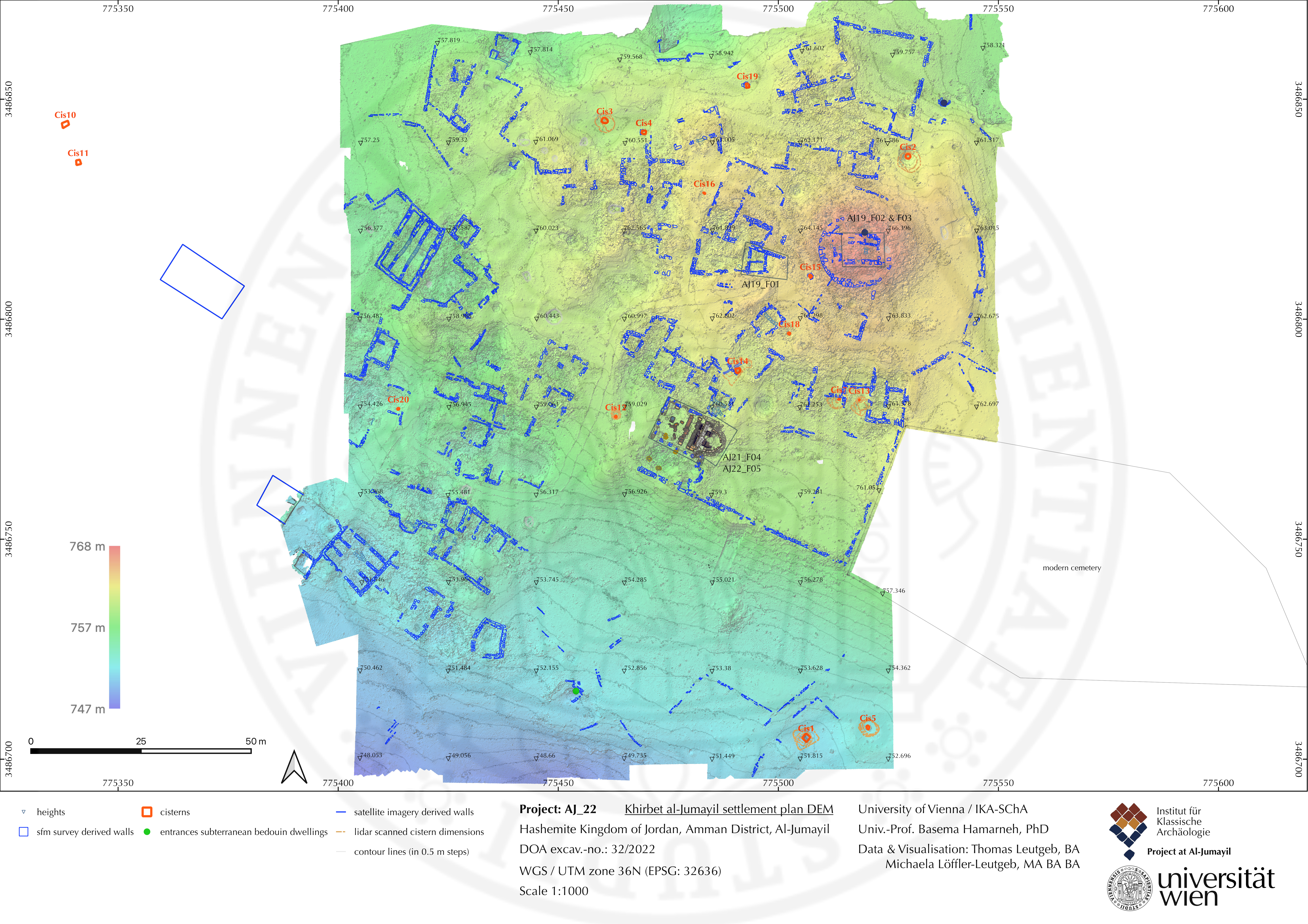
Digital elevation model (DEM) of the ancient site of al-Jumayil with plan drawing of superficially visible structural remains.
This allowing to identify a promising research area that is expected to produce results which could not be achieved with traditional archaeological techniques alone but require an interdisciplinary approach to attain a full understanding of the settlement’s development over a long occupation period (4th -8th /9th century AD).
The intention of the research project is to understand the role of a peripheral rural settlement in a holistic perspective, addressing the anthropogenic changing landscape, including the most prominent features of the built environment, material culture, and land use; types of produce/crops; water resources, environmental conditions, and economic network. The data will be used to understand how these elements impacted the development and flourishing of the settlement, and if specific conditions had a role in its demise.
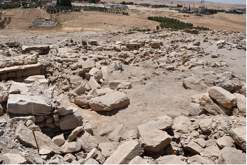
View on the excavation trench F05 from North, with modern village in the background.
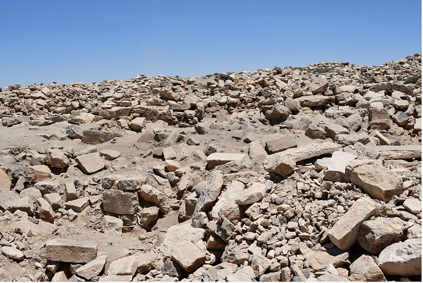
View on the excavation trench F05 from South-East.
Applying an interdisciplinary approach using tools from the humanities (history, archaeology) and natural sciences, this research project seeks to unpack the complex phenomena behind the function of a peripheral site in Late Antiquity within its regional context. This will include excavation, mapping extant structures, photogrammetric survey, geoarchaeological studies, environmental geology, archaeobotanical, zooarchaeological and anthropological. The collected data will allow us to produce a comprehensive picture of the organisation of the settlement, its inhabitants, past dietary practices, health conditions, variations in consumption patterns, fluctuation of the local economy, and preferences in agricultural production much influenced by environmental changes.
The aim is to provide bottom-up insights into human-landscape relationships within a regional and interregional network. Expected results will emphasize the multiple factors at play, lead to an understanding of the development of anthropogenic landscapes in the Levant over the long occupation period of Late Antiquity, and provide a significant contribution to a core question of scholarly debate and that has potential implications for today: the reasons behind the general decline of village- based communities and the contraction of local economy in the first decades of the 9th century, which coincides with the beginning of the Abbasid rule in the area.
VIDEO: 3D-model of an ancient pressing facility
![]()