The Archaeological Research Project at al-Jumayil (Amman Governorate)
Some Preliminary Remarks
Basema Hamarneh
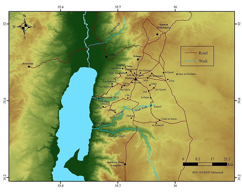
Al-Jumayil (JADIS 2309007; MEGA Jordan 2728), lies 35 km to the south west of Madaba on the road to Dhiban, and about 3,5 km to the West of the UNESCO World Heritage site of Umm er- Rasas. In the Byzantine period it was part of Provincia Arabia, falling under the ecclesiastical jurisdiction of the Bishop of Madaba (Piccirillo 2005: 378-382).
Despite of the considerable extension of the archaeological remains (150 m × 200 m), al-Jumaiyil has received only limited attention by scholars, mostly passing by on their way to Lahun or to Umm er-Rasas. Among the earliest notes of western travelers on al-Jumaiyil, are the brief mentions of Tristram (1874: 165); Vailhé (1896: 232), Brünnow and von Domaszewski (1904: 72), and Musil (1907/08: 110; 246). In 1933, Nelson Glueck gave a short description of the ruins and reported a large number of sherds dated to the Iron Age (including decorated Moabite), Nabataean, Roman and Byzantine periods. He also pointed out that the area had a great agricultural potential in ancient times, having fenced fields extending towards Umm er-Rasas (1933-1934: 36-37). In 1936 Savignac, identified a Chapel in the western side of the village (1936: 242). An important contribution to the knowledge of the area was given by the excavations of Umm er-Rasas by Piccirillo (Piccirillo and Alliata 1994). Additional information, with a reconsideration of Glueck’s early notes, was provided by a survey of Chang-Ho and ‘Attiyat in 1996 (Chang-Ho and ‘Attiyat 1997: 118-119) but no excavations have been attempted to date.
Scholarly opinion suggests identifying al-Jumaiyil with Beth Gamul mentioned in the Bible (according to Jeremiah 48, 23). The Old Testament narrative associates the Town, to other ten in the Moabite Plateau, about 910 m above the level of the Mediterranean, or 1,300 m above the Dead Sea level, rising gradually from north to south ( Benedettucci 2017: 9-17). Although the name of the site in the Byzantine epoch is still unknown, it cannot be ruled out that the village may have maintained its ancient name modified to suite modern Arabic phonetic.
The rapid agricultural and urban development of the area surrounding Umm er-Rasas, deemed it necessary to launch an intensive field investigation project at al-Jumaiyil, in order to document as much as possible of the elements related to the built environment, its surrounding landscape, and investigate how a peripherical rural settlement functioned in Late Antiquity.
Preliminary reconstruction of the main features was made by combining data from 1953 aerial photographs taken by Huntingdon Aerofilms, with satellite imagery; these were compared to the Jordanian Air Force photographic coverage of the Umm ar-Rasas – al-Jumaiyil area in 1970. The images were corrected for terrain and optical distortion, followed by the composition of a preliminary “orthophotographic” mosaic, produced using computer software. The recorded elements enabled to create data sets for more specific archaeological interpretations and provided the necessary elements to define the investigation field of research.
This resulted in the identification of a vast area of a fringed landscape that covers around 1 ha, and actually stretches from Umm er-Rasas to al-Jumaiyil, connected or shared by the two settlements. The densely exploited anthropogenic environment, argues strongly for the existence of a centrally managed system (tentatively State - Church institution- private landowners). A possible involvement of different types of landownership reflects the primary role played by the agriculture in local and regional economy (micro and macro circuits) and will be addressed in further detail in our project which aims to understand the role of a peripheral rural settlement from a holistic perspective, addressing the anthropogenic changing landscape, including the most prominent features of the built environment, material culture, and land use (agricultural production/crops, water resources, environmental conditions, and economic networks). The data will be used to understand how these elements impacted the development and flourishing of the settlement, and whether specific conditions had a role in its demise during the period of long Late Antiquity (4th-9th century AD).
The investigation is currently conducted using advanced research and documentation tools along with traditional stratigraphic excavation techniques. The campaign of 2019 focused on village dwellings while the 2021 excavation, just concluded with the participation of 9 students from IKA, has uncovered the sanctuary of a large Byzantine church with mosaic decoration. The stratigraphic excavation applied digital methods for the measurement of architectural structures in situ (3D modelling, based on the software Metashape and Capture-Reality); a digital plan of a part of the settlement of more than 20,400 m2 was also made. The pottery discovered in the 2019 campaign will soon be published in the Annual of the Department of Archaeology of Jordan. The finds of the 2021 campaign are currently under study.
Bibliography
Benedettucci, F. 2017.
Il paese di Moab nell’età del Ferro. Roma.
Brünnow, R.E. and von Domaszewski, A.,1905.
Die Provincia Arabia II. Strassburg.
Chang-Ho, C. and ̒Attiyat, T. 1997.
Archaeological Survey of the Dhiban Plateau, 1996. A Preliminary Report. ADAJ 41: 115-128.
Glueck, N. 1933/1934.
Explorations in Eastern Palestine I. The Annual of the American Schools of Oriental Research 14: 1-113.
Musil, A. 1907.
Arabia Petraea. Wien.
Piccirillo, M. 1989.
Chiese e Mosaici di Madaba. Jerusalem.
Piccirillo and Alliata 1994
M. Piccirillo and E. Alliata (eds.), Umm er-Rasas Mayfa’ah I. Gli scavi del complesso di Santo Stefano. Jerusalem.
Piccirillo, M. 2005.
Aggiornamento delle liste episcopali delle diocesi in territorio transgiordanico. LA 55: 377-394.
Savignac M.R. 1936.
Sur les pists de Transjordanie méridionale. Review Biblique 45: 234-262.
Tristram, H.B. 1874.
The Land of Moab, London.
Vailhé, S. 1896.
Dans le montagnes bleues. Échos de Notre-Dame de France à Jerusalem 9: 209-256.